Wednesday, September 22

Tripod on the AT in Maine

Fall foliage starting in Rangeley Maine


This was a re-supply trip and my last chance to camp out in the woods with Spoon and friends. I arrived at the trailhead at 2pm on Sunday to find Spoon a bit muddy, waiting with friends. We passed out some home made cookies and loaded up for the trip into Rangeley. The original plan was to do a grocery shop to augment the supplies I brought up and then head out to the shelter, but Timothy was ready for a night off, so we found a motel in Rangeley for the night. As it turned out one of his hiking friends, Zamboni, was also staying in the same place having taken a couple of days off to recover from a bout of the flu. Then we drove back out to the trailhead and picked up his 2 other friends, Joker and Watermelon, who we took to a hostel. I did a lot of shuffling on this trip, moving 4 guys around with gear, from our motel, their hostel, which was outside of town, and the town of Rangeley.

Rangeley Maine
 When we headed out for dinner that evening at a Thai restaurant  we added another hiker Connecticut Bob, who actually was from Boston and we had mutual friends from the Blue Hills. On Monday morning Tim did laundry in the morning and we packed up, did some gear shopping, picked up more food at the local IGA and headed to the trailhead with Zamboni for our 1.8 mile hike to the Piazza Rock leanto. Watermelon, who was waiting for a mail drop at the Post Office, and Joker who was waiting for a FedEx from his bank, were to join up with us later on.

Bridge on Trail
Spoon under Piazza Rock
At the trail head we ran into the Barbarian Utopia, whom I have been hearing stories about for a while and who were headed into the IGA for a quick re-supply. The Barbarian Utopia consists of a father, Tecolote and his 8 year old son, Venado, who Tim has run into on a number of occasions as they have been working their way north. Passed out some more much appreciated cookies and then it was an easy hike for the 3 of us out to the shelter. Just one small hill and then a nice stroll thru the woods. We set up our hammocks, got a fire started, and waited for the others to show up and then went up to explore Piazza Rock.We were on the top of the rock, where I took some pictures that really did not show anything. Afterwards we discovered this view and I tried to convince Spoon & Zamboni to climb back up and sit on the edge, but I couldn't get any takers. Back in camp Watermelon came in first followed by Joker and a little while later the Barbarian Utopia. Set up the grill for some Bratwurst which Joker had brought out, and washed them down with some peppermint Schnaps which Spoon lugged out.
Venado and Tecolote logging their stay

The Piazza Rock shelter had a caretaker who was paid by the Maine Appalachian Mountain Club. He worked 40 hours per week, 10 days on 4 days off and was responsible for the trail from RT 17 to the top of Saddleback. He recorded visitors to the shelter, did trail maintenance, gave us information on the local wildlife, ( he expected a moose and her 2 calves to show up), made sure the privy was clean, walked the trail daily and slept in a large tent up in the woods. His term of stay was coming to a close. Caretakers are not in residence in the winter.

Exactly as listed in the Guide Book
The privy is listed in the Guide Book as a 2 seater with a cribbage board in between. We all agreed that it would be hard to find someone to play cribbage with. No cards and missing one peg,( which would be easy to find). I have some friends who are really big into cribbage and whom I would be happy to give directions to find this location.

We got up around 7 am after a cold night in the woods, ( the temperature dropped into the low thirties), and discovered that the Barbarian Utopia had already been up,  had breakfast and left. They walk slow, they leave early, I was told. After breakfast and packing up, I was off for home and they for 17 miles to the next shelter on the other side of Saddleback Mountain.   They are having a hard time coming to the realization that this adventure is going to be over in 2 weeks. We wish them the best of luck and that the weather improves for them for the rest of their journey. Too much rain, mud, cold, slippery rocks so far in Maine. Looks like we will be heading to Katahdin in early October for the final climb.
Watermelon, Joker, Spoon, Zamboni


Friday, July 23

AT Profiles

Profile of our Hike
When we started planning our hike with Tim and projecting where along the trail we might join up with him, based on an average speed of 14 miles per day, I came up with Daleville, VA. Tim and I are both using  "The A.T Guide" by David "AWOL" Miller as our way of following his north bound progress. One of the nice things about this guide is the trail profile that runs from page to page. So looking at the elevation profile for the section in Virginia from Daleville to the James River, it did not look too bad. A few bumps to start off with, but nothing over 2,700 feet, until we passed Buchanan. Then there was a climb up to Apple Orchard Mountain, but it was stretched out over 12 miles, and then down hill to the James River. I figured that the 12 mile lead up to Apple Orchard should not be too strenuous.  Tim put on some extra miles and so instead of Daleville we met up with him in Buchanan 20 miles further up the road. So when we started out on the hike, it would be nice to say that we got on the trail at Jennings Creek and just followed the profile line up to the top of Fork Mtn. and then Floyd and on, but that was not really the case. In New Hampshire I have found that most of the trails do that. The mountain is up there and we hike up to it in a direct line. When we hiked in Montana, we found more slabs, trails that zig zagged their way to the top. Made it a bit easier and probably a little longer. In Virginia I found combination's of both. We were heading from the south to north and as I remember there was more slabbing going up the hills and then followed by trails that went straight down, with the exception of High Cock Knob which nearly did me in. Straight up High Cock and straight down the other side. Steep downs are just as hard as steep ups. Different muscles in use. The next three images were taken from Google Earth with a gps track overlayed in red to show our path. I did not carry my own gps on this hike because I did not want to have carry the weight of the extra batteries, so I found  this  track on the web. This track also listed all the shelters from Springer Mountain in Georgia to Katadhin in Maine. If you click on the pictures they will enlarge for a better view.


 Fork Mountain trail starts on the bottom left goes up to the top of Fork Mountain and down to the plush shelter at Bryant ridge. Then up over Floyd and at the top of the picture the other yellow push pin is Cornelius Creek Shelter, where we spent the first night.
This picture is looking East with Apple Orchard Mountain on the right and moving to the left Thunder Hill Shelter, where we spent the second night. Then the next day continuing up over High Cock Knob and down to Marble Spring where  we spent the third night.

James River

Looking  West with the James river on the right and the trail descending from the mountains past Matts Creek Shelter on the way to the river. That was our hike, a few twists and turns and some long ups and downs.

Monday, July 12

Hiking with Tim

"Buchanan, VA"

On June 28, Ellen, Sean & I in Marion got up early  and 11 hours later we arrived in Buchanan, VA where Tim, who had to walk 4 1/2 miles from the trail, had already checked into our motel. Out for dinner that evening and breakfast the following morning and we were at the trailhead on Jennings Creek Rd at Panther Ford by 10:30 am, packs on and ready to go.Panther Ford was so named because supposedly a young woman and her son were killed there by a mountain lion in the early 1800's. There aren't any mountain lions around here any more so we felt safe to go.


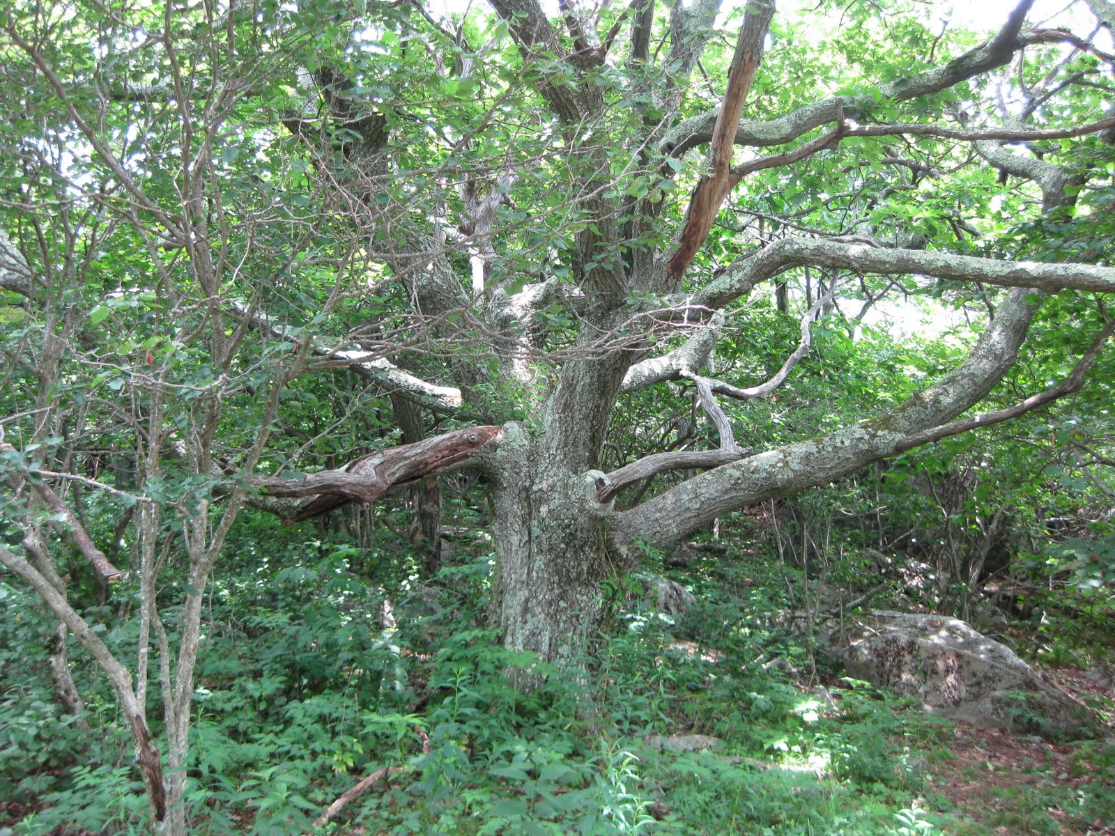
We have hiked together on a number of occasions and usually the boys start off at a faster pace, then stop  up the trail and wait for me to catch up. The trail started right up the hill, without any easy, level,  warm up section. It was hot and very humid , it took me a while to get going and I was completely drenched in sweat in less than 15 minutes. Fork Mountain was our first climb going up from 951 feet elevation at the road to 2042 feet at the top in about 1.5 miles. Then down the other side to an elevation of about 1,100 and then up 250 feet to the shelter at Bryant Ridge. Fork Mountain was relatively easy, in that we hiked to the top and then hiked down. The next mountain, Floyd, was not as easy. There were more ups and downs on the way to the top. Tim calls them PUDS, (Pointless up and downs). Bryant Ridge Shelter below Fork Mountain was a 3 decker capable of sleeping 16 people, complete with pegs for stuff and hooks for packs. It was really some nice, especially for someone who had never seen a shelter before. Our leader also confirmed that it was one of the nicest he had seen.
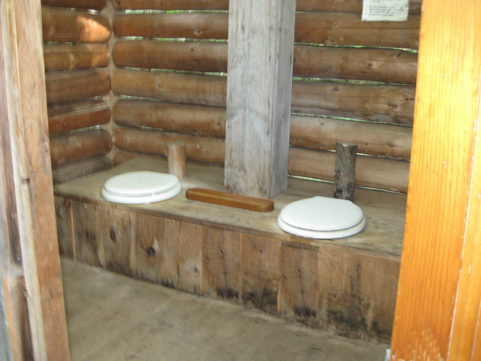
We arrived at the shelter separately, with Sean the first in. When I came up the small hill to the shelter Sean was bandaging up some cuts. He had spotted the shelter as he was coming down the trail and took a shortcut up to it, but in doing so he walked into a Black snake on a ledge and while attempting to avoid the snake had fallen back down the hill. I am not afraid of snakes, but this one was really huge, at least 4" in diameter and probably close to 6 feet long. It must have just had a meal and was resting in the sun. We laid our wet clothes out on the picnic table and had lunch inside in the shade. Then around 2 pm off again and up Floyd Mountain which was 3,560 feet high and 4+ miles away. There were times going up Floyd when I wondered why I thought that this was a good idea, but eventually with some help from Tim, who came back and carried my pack for a while, I made it to the top. There are not a lot of views at the top of these hills. The only way you can tell you are there is by looking around and making sure that the sky is not blocked by trees. False summits are a pain. A number of times we arrived at what seemed to be the top of the hill only to realize that we could only see 3 quarters of the way around. Then you go down into a little notch and start back up again. From the top of Floyd we descended 400 feet to the Cornelius Creek Shelter, arriving after 7:30 pm having hiked about 8 miles. . This was a much smaller shelter than the Bryant Ridge and it only slept 8. There was one other hiker there who called himself "Tabasco" . Tim allowed how this was about the third person with this trail name, but he did not know him. Tabasco slept in a hammock like Tim's, and because it was late and no one else was there Tim and Sean elected to sleep in the shelter. I however set up my hammock in the woods behind the shelter. Tim uses a Hennessey which you climb into thru a slit in the bottom, that closes up with Velcro after you get in. I bought a Clark Jungle Hammock that allows you to get in conventionally and with bug net that zips up. The bug net on the Hennessey is attached directly to the hammock, always in place. I went the hammock way, because I did not want to sleep on the hard ground in a tent or on the boards of a shelter. There aren't any beds in the shelters.
"Packing up at Cornelius Creek Shelter"
The shelters are 3 sided affairs, with wooden floors. Lay down your pad to mark your space and put down your sleeping bag. Too hard for my old bones. If we had, had rain I probably would have changed my mind, but the weather stayed dry, so I slept out for 3 nights. We cooked up dinners and then packed it in for the evening.

The next morning we were up around 8, breakfasted and packed and ready to go around 10 am. This was the earliest we got off in the next couple of days. Thursday and Friday we were back to 10:30 departure times. We only did 5 miles on Wednesday, up and over the highest peak between Virginia and New Hampshire, Apple Orchard Mountain.There were no apples on the mountain just a radar dome for FAA flight control. The early settlers thought that the stunted Red Oak trees were Apple trees. The Oak trees are still there. After a rest and lunch on the grass in front of the Radar dome we started down hill towards Petites Gap. After the trail entered the woods it descended over 100 stone steps to the Guillotine, a suspended boulder and then continued on to Thunder Hill Shelter were we spent the night camped out behind it, Sean in his tent and Tim & I in our hammocks. For dinner Sean made Salmon cakes that were absolutely delicious.
"I thought it was an Apple Tree"


"Sean setting up his tent at Thunder Hill. Bear bag can be seen hanging in tree upper left"


"Looking at Tim's Hammock from mine"

Thursday we hiked around 7 miles. Apple Orchard Mountain was the highest point on our hike and from there it was down hill to the James River foot bridge. However in between there were few more of those PUDS, the worst being High Cock Knob at 3073 feet, with 3 false summits. Sean & Tim stayed and read their books on Thunder Ridge and I got to head off first for a while. I was making good time down hill, across Petites Gap road and had just started up High Cock Knob when they caught up with me and passed. They were surprised how far along I had gotten. I tried to keep up with them,but was not able to and went back to my slow uphill pace. Tim came back and helped me up over the second false summit and told me that the top was just a short climb away. we first had to go down to a notch before resuming our climb. This notch is called Archie's Notch after Archibald "Bear" Tolley, who was a bear hunter in the 1800's and had a cabin nearby. He had 2 pet roosters who crowed from a tall oak on the top of the promontory.  We found Sean wedged between a couple of rocks at the top reading and resting.and left him there as we headed down to Marble Springs Campground where we made camp for the evening.
Tim told us the following morning that a huge bear walked around the campground, but I never saw or heard him. I did keep everyone up for a while trying to get my hammock adjusted. The next day, although long, it was all down hill with plenty of good views and a nice stop for lunch before we crossed the James River on the longest footbridge on the AT.


We had planned on spending one more night camping, but decided after crossing the bridge that we had done enough and then ran into a little problem of calling Ellen for a pick up. Even with 3 separate carriers none of us had cell phone coverage. Tim managed to get a ride headed for a phone at a gas station in Big Island, and on top of a hill on the way they picked up reception and he made contact with Ellen and we were headed for dinner and beds with air conditioning. Tim slackpacked,(Ellen dropped him off where she had picked us up on Friday with just water and snacks), Saturday for 12 miles. We picked him up around 1pm,  came back to the motel for some more rest and then Sunday morning we set him off again on the trail, before we drove home.


Sunday, June 27

Heading for Buchanan, VA

Tomorrow Sean, Ellen & I head off for Buchanan, VA to join up with Tim who is on the Appalachian Trail heading north. He will have done about 747 miles when we meet up with him tomorrow. The three of us will be on the trail on Tuesday,  and Ellen will be headed off to spend some time at a B&B with Llamas and if her luck holds she might actually  be able to do a little trekking with one. I will get some pictures and get them posted probably after we get home. The picture above was taken in March, on our way back from Florida. The leaves should be out now, so hopefully we will get some good views. We are hoping for cool dry weather and get out of these muggies, here in New England. The trail follows the Blue Ridge Parkway and as we leave Buchanan we will be climbing up to 4,200 feet going over Apple Orchard Mountain and then down thru the Guillotine. From there it is mostly down hill to the James River, where we get to cross the longest foot bridge on the trail and then back up to  Buena Vista, VA. That would put us about 50 miles from Buchanan and that would be my goal for this trip. So wish us well and we will be in touch.

Wednesday, May 19

NOBO

Joe's "Clark's Jungle Hammock"
NOBO is actually a term used in describing a hiker and the direction he is going on the Appalachian Trail also known as the AT. Timothy has taken a 6 month leave of absence from Marina Management in Florida and on May 1 he started hiking the AT from Springer Mountain in Georgia,  heading North . Yesterday he was at Fontana Village, NC and spent the night at the Fontana  Hilton before heading into the Great Smokey Mountain National Park today. If you have ever read Bill Bryson's book, "A Walk in the Woods" , you know that hikers  have trail names. When Tim started, he did not have a name, but shortly after leaving Springer, he became "Spoon'. Seems that when he was ordering his gear from REI, he wasn't paying close attention to the items he purchased, just checking things off his list and moving on. So he ordered a spork, which is a spoon fork combination, and he also ordered another spoon combination thing. When he got his package from REI out came this huge plastic ladle/spoon thing about foot and half long. Chuckled about it and because it was really light thru it in the pack anyway. When he got to the first shelter, and started to cook dinner, with some friends he had met on the trail, Matt's girlfriend said that she had forgotten to bring any thing to eat with, and Tim said "I have just the thing for you" and pulled out his giant spoon. So his friends started calling him Spoon. I guess he tried to object but, then of course the whole shelter picked up on the name and continued calling him "Spoon". So "Spoon" he is!!! He carries enough food for 3 to 4 days on the trail and when he stops for food, he usually updates his blog. He wasn't able to find a WiFi connection in Fontana, so it looks like Gatlinburg will be his next opportunity for blogging. You can subscribe or view his blog at: The AT & T
Spoon at Tray Gap

          So the hammock above is my hammock. Sean & I are planning on joining him for 4 days at the end of June or the beginning of July,  somewhere in Virginia. Tim actually started talking about this hike last fall and he and I had a lot of discussions about gear and  planning. He originally planned to leave in April, but then because of his work load, he decided in early March, that he wasn't going to be able to go. My plan had been to start off with him at Springer, figuring that I could keep up with him when he first started, and Sean was going to join him later. So when Ellen & I were snowbound at Newfound Gap, in the Great Smokey Mountains on our way home from Florida, I was glad that he had made the decision not to start this year. But by Easter he had changed his mind and started ordering his gear and announced that May 1 was starting his starting date. Tim is using a Hennessey hammock, recommended by his friend Rob, and says that it is working fine. Light weight , no poles , easy to set up. All the reasons I chose plus not having to sleep on the cold ground. My old bones do not like sleeping on the cold hard ground or the hard wooden floors in the shelters.
Tim resting in his hammock in Gerogia


          We are following his progress north, he has been averaging about 14 miles per day, and we are looking forward to meeting up with him in Virgina in about a month. I am packed and am carrying my fully loaded pack as I lead hikes in the Blue Hills on Thursday evenings with the SE Mass Chapter of the AMC's Red Line the Blue Hills hike series.

Monday, March 29

Leaving Gatlinburg

Sunday morning we got on our hiking gear, took a little tour through Gatlinburg, before heading to the Laurel Falls trail.  Once in the park we saw that the road over the top was closed for snow and ice conditions. The trailhead tor the falls was off on a different road so we took that hoping that the weather would break, so after we finished our hike, the road would be open.  It was a little bit of a climb up to the falls and almost 2 miles , but the trail was well packed without rocks or roots so it was easy going. With all the rain, the streams were really running and the falls were quite spectacular. We were thinking that we would have to drive around to get to Asheville but the rangers had opened the road and we headed on. The Appalachian Trail crosses the road at Newfound Gap, so we stopped and took some pictures, then on down the other side and on to Asheville.
We had a nice time in Asheville. Really liked the city, with lots of cafes, and little traffic. After we arrived we got out and walked around, looked at the art work on the streets, had a little coffee and decided on a place to go for dinner. Asheville has a really nice bookstore!! Actually Asheville has a lot of nice places to visit. We had a great dinner at the Lobster Trap which is also known as Oyster Brewing and although we were not able to sample their signature brew- Oyster Stout- their IPA was quite good. When we walked in, Ellen said, "they use the same brewing system you do". Theirs is actually a little more sophisticated but the principles are the same. A two tier system, but I do not have a keg mash tun.(anyone interested I can explain??) So I had a couple of drafts and some jambalaya, and we both were quite happy. The next day we did some shopping in the local wine store and then on to some serious antiquing. Ellen found a nice tin carrier that she can use for plants, but I lucked out on my search for a grain scale and some apple peelers. We decided this wasn't apple country nor an area with grain silos. Then on to the Blue Ridge Parkway. First we stopped at the visitor center where we found out which parts of the parkway were open and which were closed and then a visit to the Craft store for some pottery for Ellen. There were a number of sections of the parkway that were closed for construction and storm damage so we are definitely going to have to come back to see those sections. We got on at Linville Falls and stayed on to Deep Gap. It actually was the last section of the Blue Ridge parkway that was completed. A lot of the road was held up by columns and subsequently the elevated road ran out along side the ridge rather than over it. It made for some rather spectacular views. One of the things that was really apparent in the North Carolina section , was the wind/snow storm damage on the trees. It looked like a giant had taken a scythe and swiped off the tops of the trees. Tree tops were down everywhere and you could see where they had been ground up . But there was still substantial more work to be done to clean up the roadway and hills. We spent the night in Wilkesboro, NC and the next day got back on the Blue Ridge Parkway at Roaring Gap, finishing North Carolina and then we were able to go to the end of the Virginia section. We saw lots of deer, 1 wild turkey and 2 Mountain Goats. After the Virginia section we went into the Shenandoah National Park and onto the Skyline Drive. We did not take the Skyline to the end but got off and spent the night in Winchester, VA. The next day was was the last day of our vacation and was spent on a long ride home on the interstates, going from Virginia, through West Virginia, Maryland, Pennsylvania, New Jersey, New York, Connecticut, Rhode Island and finally Massachusetts and home. There are more pictures of our trip filed on the right hand side of the blog under "Other Stuff" click on Florida Vacation 2010 and it will take you right there.

Tuesday, March 16

Leaving Delray


Thomas Edison with a couple of friends


For our final dinner in Delray Tim fixed us giant grilled shrimp and Florida Stone crabs. It was a great meal to end our vacation on the East Coast of Florida. Thursday morning we said goodbye, dropped off a geocoin that we had previously picked up in Arizona and headed across Alligator Alley under cloudy skies for John & Daphne's in Fort Myers. The sky cleared by the time we arrived and they took us to the Thomas Edison - Henry Ford`museum. Edison bought property in Fort Myers for his winter home in 1895. He came here for winter relaxation with his family and to conduct botany studies. Henry Ford, who had been employed by Edison for 2 years before he started building cars also bought a piece of property next to Edison's. Edison did the planning for the property from the artesian wells for the swimming pool to the landscaping and home and lab designs.

We enjoyed our brief stay with John & Daphne, having a nice dinner and some evening conversation.


Daphne, Joe and Ellen, Emma, John and Cricket

Then Friday we were bound for Georgia under threatening skies. The clouds opened up and we had some torrential rainfall to the other side of Tampa. When Ellen checked in to our Motel in Tifton , GA she heard stories of lots of cars off the road both North and South of us. Rt. 75 North from Fort Myers to the Florida Border was very interesting. Lot's of terrain changes. However in Georgia Rt. 75 becomes a billboard infested road. I-hop, sex, land deals, you name it and it is advertised. Interesting move from fireworks to sex. We are hoping that as we get further in the billboards will disappear.
We left Tifton Georgia heading for the Great Smoky National Forest. As we were heading north I noticed that my gps was telling me that I was going about 2 mph less than what was being shown on my car speedometer. I guess that we haven't gone as far as we thought or my mileage isn't quite as good. The billboards continued to plague us on our trip north until after Gainesville. Where the terrain also changed and we were able to see the mountains we were heading for. We stopped at Tallulah Gorge for pictures and a break. The Great Walenda crossed the gorge on a wire in 1970, 6 years later he died in Puerto Rico attempting another high wire crossing. In Dillard we saw our first snow on the way north and we were still in Georgia.As we drove up through the Great Smoky National Park, the temperature began to drop and the rain turned to snow. We were not in a blizzard but the snow was definitely coming down and the visibility was very poor.


At the top of Newfound Gap, one foot in TN, One foot in NC

We are hoping that this storm is going to clear tomorrow so we can get some hiking in. After coming down from the ridge we entered Gatlinburg to a horrendous traffic jam. We found out that we had just missed the Santa Claus parade and traffic was backed up from one end of the town to the other. Found a place to stay and are hoping for a better day Sunday.

Wednesday, March 10

Continuing South part II


St. George St. The oldest wooden schoolhouse


After we left the Watts in Hilton Head our plan was to spend the night in St Augustine to explore the oldest city in the US and some more touring on Tuesday before heading to Tim's in Delray. We needed to leave St. Augustine around 1pm to rendezvous with Tim after work. After we went through Jacksonville, we took a little detour to Green Cove Springs. This actually turned into a nice drive along the St. John River. Lots of farms and old houses with lots of moss hanging down. There were sections that reminded us of Coral Gables. Then back across the river into a marine industrial park.

The de-commissioned CGC Bramble

At one time the Hornbeam was supposedly here, but when we arrived only the Coast Guard Cutter Bramble was tied up to the dock. Seemed really strange seeing her painted white. We had lunch along side the dock and then continued to St. Augustine. A good friend suggested we stay at the Ponce de Leon. I very nice place he had stayed at in his youth. Sadly Billy, it is now a part of Flagler University, and although we probably could have gotten good rates in the dormitory, we elected for a more conventional motel. We got out and went for a walk in the old town, which is now pretty much gentrified with boutiques in all the old houses. Lots of signs "Bikers Welcome" We believe that it was biker week in Datona, but St. Augustine seemed to have it's share as well. We had a nice dinner at a Bavarian Restaurant.
Ellen had Veal Oscar and I Salmon stuffed with crab. Finished off with an Irish coffee and Cream Brule. Tuesday we checked out and went and toured the fort. It was really quite impressive. The Spanish had quite a fortification and although it was never captured the town was overrun a number of times. Lots of really big cannon up on the walls.

Entrance to Spanish Fort

Then we found a hot sauce shop and did some sampling and buying, then headed down to Tim's, for the first time on I 95 since RI. Straight fast and boring.

So we have been here for a week. The water has not been conducive for swimming, but the temps have been up in the 60's and low 70's. We have done some geocaching, beaching, and boating. Tim has a friend with a 38' Bayliner who took us on a ride on Saturday on the intercoastal from Boynton Beach to the Boca Raton Basin & back. Lot's of nice houses and boats to look at along with some good food and beer. Sunday we went to Wellington for Polo at the Palm Beach Polo Club.

Polo Match Palm Beach Polo Club

Lot's of good people watching, although the horsemanship all took place at the opposite end of the field from where we were sitting. There were 6 periods for the match. At the half everyone flocked onto the field to push down the horse hoof divets and for the free champagne, Frisbees, polo balls & ice cream.

The mad rush across the field stomping the divets

It was a nice afternoon under beautiful skies. Monday Ellen & I did the Lake Trail on Palm Island, in Palm Beach.

One of the few houses visible along the Palm Island Trail

It is a pathway in front of all the beautiful houses, that of course you can't see because of all the manicured bushes in front of their houses. It was nice walking along the water, on a cool day under that beautiful Florida sun. Thursday we begin our trek north, first stopping to visit John & Daphne in Fort Myers.

Monday, March 8

Continuing South

The Lady of the House-Hampton Plantation

Now that we are back from the beach, we can again take up our journey south to Delray Beach. I would say though,that today the sun was out , the sky was blue, a light breeze was blowing out of the north, temperature around 66, but the water was still a little cold for anything more than wadding. A nice day to sit on the beach and read.
Before we got to Charleston we stopped at the Hampton Plantation for lunch. We were too late for the tour but we had a pleasant walk on the grounds.

Oaks & Moss at Hampton Plantation

Saw the tree that George Washington was reported to have saved. Took some pictures and continued on our way. David Bishop purchased a new GPS for his new car and gave me his old one, which I have to say has been a real godsend. For some reason the maps I thought I had downloaded into my handheld for this trip, ended up going somewhere else. So we are really grateful for David's gift. We breezed Through Charleston crossing over the Broad River on one of those new suspension bridges and continued south on 17 to Hilton Head Plantation. We arrived at the Watts home and were greeted by Alex And Katy, got a hug from Lindsay and a glass of Sierra Nevada from John. The Sierra Nevada came in a growler.

John and Lindsay,Katy and Alex

This is something we definitely need in Massachusetts. John got his at the Lodge, I believe, where they have over 20 craft beers on tap. You make your choice, either buy a growler or use your own, and have it filled. When we visited Missoula Sean took me to a brewery that put up beer in growlers, but it was only their beer. John cooked dinner for us, roasted red potatoes, fresh salad and grilled marinated flank steak, which was absolutely delicious. It was early to bed, the Watts needed to get off to school and work on Monday and we to continue south to St. Augustine.

Friday, March 5

Highland Park to Delray Beach

Wright Memorial


Actually this should be titled a culinary tour of the East Coast visiting Family and Friends. We went from lunch with Allison in Highland Park, NJ to eating out in a diner in Seaford,DE, gourmet meals in Duck, NC, A delicious meal in Calabash, NC prepared by a Cordon Bleu Chef, Southern cooking in Hilton Head, SC and finished in Delray Beach with a tastily grilled chicken. We traveled 1828 miles from Marion, traveling on interstate highways and back country roads. After lunch with Allison we got back on the road planning on making it south of Dover, DE. We ended up in Seaford, De where we went out to dinner at the Seaford diner. The next day we continued on down the Eastern Shore, crossed over the Chesapeake bridge and tunnel BHeading for Duck, NC. We took a couple of side trips exploring coastal North Carolina, the most memorable out Waterlily rd. in Coinjock.Ellen on Albemarle

Ellen on Albemarle Canal

Stopped alongside the Albemarle Canal for some picture taking and then over the bridge to Duck, and David & Kathy's home. That evening we had Kathy's recipe for Jambalaya with rice. The next day David took us for a tour of the outer banks including the Wright Memorial, Bodie Island Lighthouse, which was being repaired, Hatteras Light and the Chicanacomico Life Saving station in Rodanthe. We also visited the graves of 2 british merchant sailors whose bodies washe ashore after there ship was sunk by a German sub during WWII. There are also another set of graves in Ocracoke of 6 Royal Navy sailors from another ship sunk by a German Sub

British Merchants graves


Bodie Light

Then back to Kathy & Davids for New England Clam Chowder and fresh shrimp for dinner.

David, Ellen, Kathy, Joe, Chloe

Saturday we headed down the coast on RT 17 going through New Bern, and Wilmington before reaching Calabash and Maggie & Peters house.

A cold day on Atlantic Beach

Maggie regaled us with some very funny and sad stories of her tutoring in the Wilmington school. We also found out that Peter was trained as a Cordon Bleu chef and he put that education to work in preparing our dinner. The next day we left for Hilton Head again going down the coast through Myrtle Beach heading for Charleston.

Joe, Ellen, Maggie, Peter

I am going to take a break here and will pick up the rest of the trip south later this weekend, from Charleston to Hilton Head to St. Augustine and then Delray Beach, where we have been enjoying some rather cool days although we have been getting to the beach, but not in the water.